
A geohydrological investigation refers to the study and analysis of the physical and chemical properties of groundwater and the geological conditions that influence its movement and distribution. This type of investigation is often conducted to understand water resources, groundwater behavior, aquifer properties, and potential impacts of human activity or environmental changes. It combines elements of geology, hydrology, and hydrogeology.
The data collected during the fieldwork is then analyzed to create a conceptual model of the groundwater system in the study area. This model may include information on the depth and thickness of aquifers, the recharge and discharge areas, and the direction and rate of groundwater flow.
The results of a geohydrological investigation can be used to make informed decisions regarding the management and development of groundwater resources. For example, the investigation may help identify suitable locations for well drilling, design efficient groundwater recharge systems, or determine the potential impacts of land use changes on the groundwater system.
Overall, geohydrological investigation plays a critical role in the sustainable management of groundwater resources, helping ensure that these resources are utilized in an efficient and environmentally sound manner.
The results of a geohydrological investigation can be used to make informed decisions regarding the management and development of groundwater resources. For example, the investigation may help identify suitable locations for well drilling, design efficient groundwater recharge systems, or determine the potential impacts of land use changes on the groundwater system.
Our team can help you find suitable well locations and implement water management systems.
A geological survey is a scientific study that examines the physical properties of the earth, which provides information about geological hazards, mineral resources, soil properties, and environmental impacts.
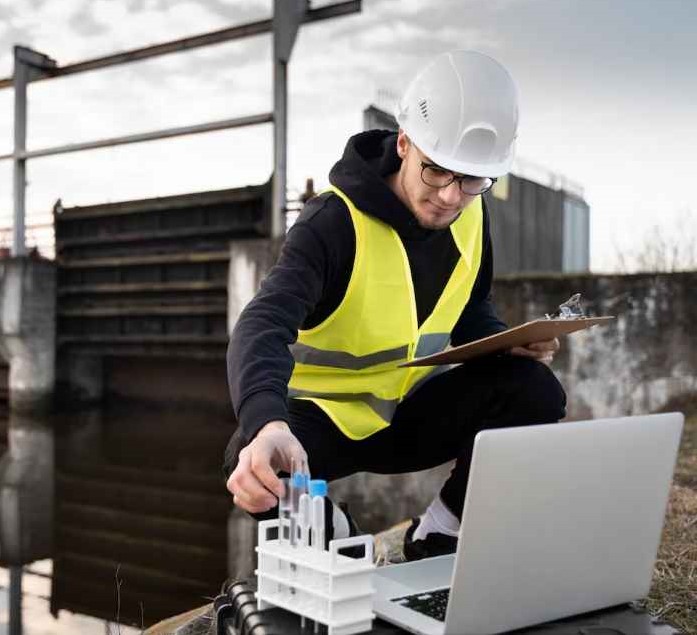
A hydrological survey is a scientific study that examines the characteristics of water resources, which provides information about water resources, water quality, and the impact of human activities on water resources.
Our team of experienced professionals uses state-of-the-art equipment and techniques to provide you with accurate and reliable data. Contact us today to learn more about how we can help you with our geological and hydrological survey services in Ahmedabad and all over India! contact now.
A geological survey is a scientific study that examines the physical properties of the earth, which provides information about geological hazards, mineral resources, soil properties, and environmental impacts.
A hydrological survey is a scientific study that examines the characteristics of water resources, which provides information about water resources, water quality, and the impact of human activities on water resources.
Our team of experienced professionals uses state-of-the-art equipment and techniques to provide you with accurate and reliable data. Contact us today to learn more about how we can help you with our geological and hydrological survey services in Ahmedabad and all over India! contact now.

Simplifying groundwater compliance for businesses across India. Reva Consultancy provides CGWA NOC facilitation, water audits, hydrogeological surveys, and rainwater recharge planning for sustainable operations.
+91 909 902 6288
+91-787 461 3793
sales@revaconsultancy.in
407, Pushti Sparsh Arcade Opp Rathi Appartment, BRTS Bus Stand Acher, Sabarmati, Ahmedabad, Gujarat 380005
© 2026 Reva Consultancy All Rights Reserved